STUDYING THE PAST TO PLAN FOR FUTURE
CEMETERY LOCATION –– Survey Map
Who chose the cemetery’s location? We don’t know, but mining town cemeteries often were placed on land less likely to be built upon or mined. Most of the cemetery, however, is located on part of the Enterprise Lode, claimed in 1912 by Clifford H. and Margaret Martin, with N.E.(Norman) Brimhall, as recorded in the Boulder County Clerk and Recorders Office.
The Martins and Brimhall patented the Enterprise (#19828) in 1919. It embraces portions of sections 4, 5, 8, and 9 in Township 1 South, Range 73 West in the Grand Island Mining District of Boulder County, Colorado. The USGS map on the right shows part of the access road to the cemetery on U.S. Forest Service land between the Enterprise and Don lodes.

CEMETERY PERIMETER –– Aerial View
This aerial view of the cemetery’s boundary lines (on a larger scale than the above map) shows the same intersecting roads (at the bottom of the photo, and overlapping the word “Enterprise” on the survey map). The beginning of this same road (in red) continues along the cemetery's northeast boundary. Current access is pedestrian-only. (Map courtesy Grand Island Resources)


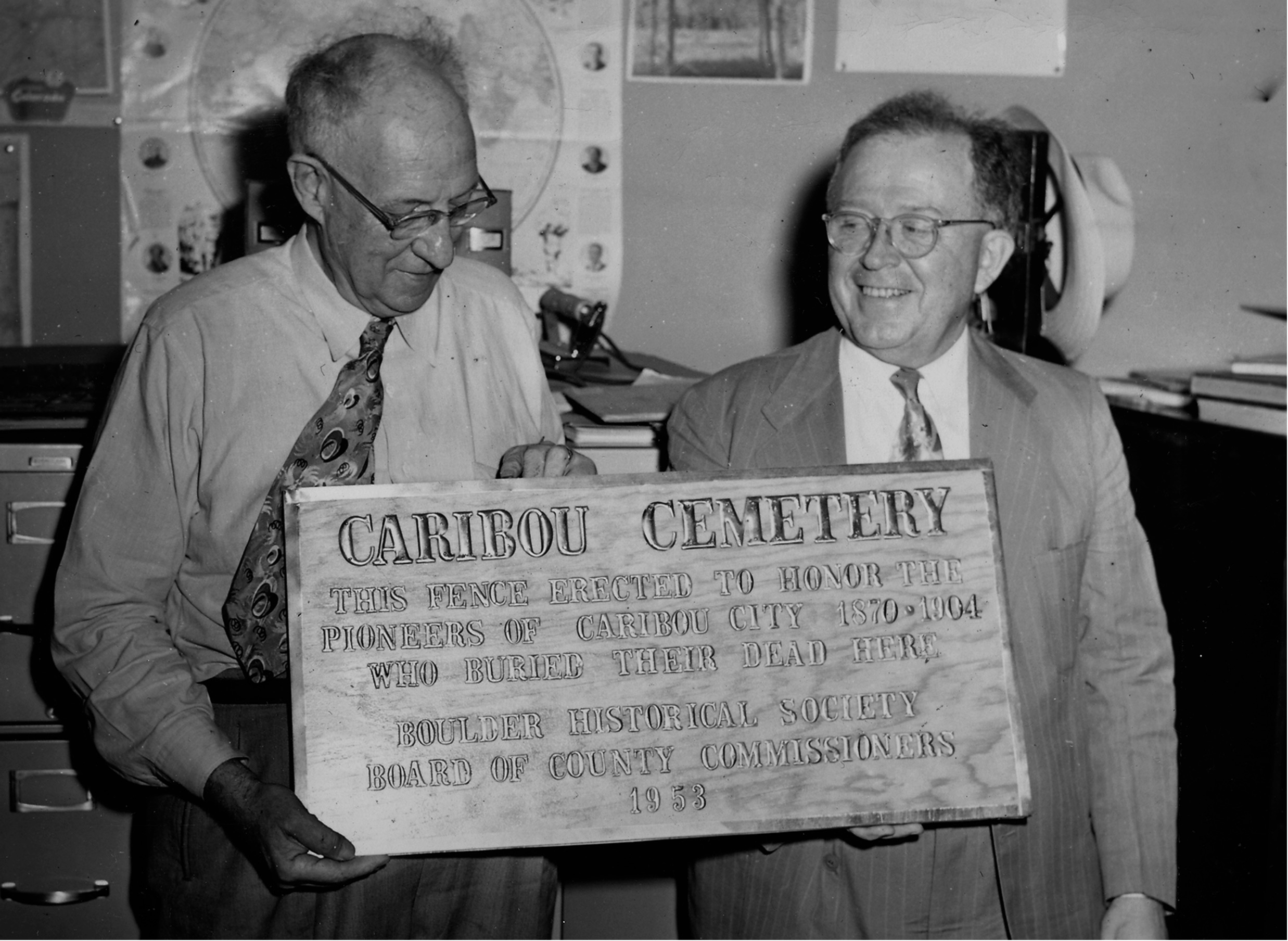
In 1953, the Boulder Historical Society and the Board of County Commissioners erected a barbed wire fence around the cemetery. Both photos from 1953 (Carnegie Library and Denver Public Library).
ARTICLES FROM 1953


EARLY BURIALS –– WHO AND WHERE?
The first known burials in the Caribou Cemetery were in 1875. The last one in the 19th-century was in 1898. Then, for 60 years, there were no burials. In the more recent past, the burials began again in 1958, with the latest, Thomas S. Hendricks, in 2020.
A list of the historic gravestones was made in 1940, and again in 1972, by volunteers who read names on the then-legible stones. Apparently, there was no plot map and, likely, no grid-like organization. With rocky soil that was frozen for much of the year, families buried their dead wherever they could.
Go to PHASE-2 for historic photos of some of the above gravesites. Sadly, only their foundations remain today. See page on BURIALS for a list of all burials from 1875 to 2020.
HOW TO DONATE
Your donations are much appreciated and are
tax-deductible through the NAHS, a 501(c)(3).
Kindly send us a message on the Contact Form to make sure your money is earmarked for the cemetery.
Your donation will be acknowledged on a DONOR PLAQUE.
Click below, or mail your check to:
Nederland Area Historical Society
PO BOX 1252
Nederland, CO 80466